Category:De Onderneming, Witmarsum
Jump to navigation
Jump to search
| Object location | | View all coordinates using: OpenStreetMap |
|---|
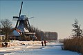
windmill in Witmarsum, Netherlands  | |||||
| Upload media | |||||
| Instance of | |||||
|---|---|---|---|---|---|
| Location | Witmarsum, Wûnseradiel | ||||
| Street address |
| ||||
| Located on street |
| ||||
| Has use | |||||
| Heritage designation |
| ||||
| Source of energy | |||||
 | |||||
|
This is a category about rijksmonument number 39437
|
| Address |
|
Media in category "De Onderneming, Witmarsum"
The following 24 files are in this category, out of 24 total.
-
 0 De Undernimming, Wytmarsum.jpg 1,600 × 1,068; 757 KB
-
 20190821 molen de Onderneming in Witmarsum.jpg 3,456 × 5,184; 3.66 MB
-
 20190821 Witmarsumervaart met molen de Onderneming Witmarsum.jpg 4,032 × 3,024; 1.29 MB
-
 2023 Wytmarsum, nôt- en pelmûne De Undernimming.jpg 1,600 × 1,065; 1.11 MB
-

-

-

-
 Balie van achtkante stellingmolen - AMR Molenfoto - 20539311 - RCE.jpg 900 × 600; 100 KB
-

-
 De Undernimming, Wytmarsum.jpg 1,406 × 939; 588 KB
-

-

-

-

-
 Korenmolen "De Onderneming" - Witmarsum - 20215688 - RCE.jpg 1,200 × 1,181; 290 KB
-
 Korenmolen "De Onderneming", aanzicht - Witmarsum - 20215673 - RCE.jpg 1,200 × 958; 219 KB
-
 Korenmolen "De Onderneming", aanzicht - Witmarsum - 20215674 - RCE.jpg 964 × 1,200; 243 KB
-
 Korenmolen "De Onderneming", aanzicht - Witmarsum - 20215675 - RCE.jpg 1,200 × 1,181; 249 KB
-
 Korenmolen "De Onderneming", aanzicht - Witmarsum - 20215676 - RCE.jpg 1,200 × 1,184; 229 KB
-
 Korenmolen "De Onderneming", Molenaarshuis - Witmarsum - 20215680 - RCE.jpg 1,200 × 1,177; 331 KB
-
 Korenmolen "De Onderneming", oost aanbouw - Witmarsum - 20215679 - RCE.jpg 1,200 × 1,191; 316 KB
-
 Korenmolen "De Onderneming", stichtingsteen - Witmarsum - 20215677 - RCE.jpg 1,200 × 1,186; 373 KB
-
 Korenmolen "De Onderneming", west aanbouw - Witmarsum - 20215678 - RCE.jpg 1,200 × 1,175; 300 KB
-
 Witmarsum - molen De Onderneming.jpg 1,300 × 1,950; 1.22 MB


